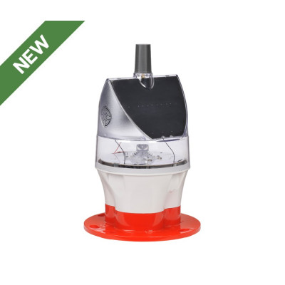


The Sealite SL-75 lantern is a next-generation solar marine lantern with up to 5NM visible range. Its dual panel design is unique in its ability to ‘track the sun’ and operate reliably in low sunlight environments such as the UK, Canada and Europe.
The SL-75 lantern is a next-generation solar marine lantern with up to 5NM visible range. Its dual panel design is unique in its ability to ‘track the sun’ and operate reliably in low sunlight environments such as the UK, Canada and Europe.
Completely programmable via the SealitePro® App, configure and monitor the SL-75 from a distance up to 50 metres. An inbuilt solar calculator confirms the lanterns optimal operating performance, at the set location.
Angled solar modules obtain maximum sunlight capture, allowing the unit to operate reliably in a range of low sunlight environments. Tilted solar modules are less susceptible to fouling or snow cover.
Synchronise two or more lanterns to flash in unison via an internal GPS module. Synchronised flash helps to clearly distinguish from other aids to navigation and background lighting - ideal for rivers, marina entrances, channel marking and aquaculture applications.
Access real-time diagnostic data and adjust lantern settings via cell-phone. Lantern can be configured to send alarms via SMS text messages or email including lantern reporting.
The SL-75 is available with an optional integrated Iridium® Satellite module enabling two-way monitoring and control using Earth Orbit satellite network.